Study Alternatives (October 2012)
Below you will see 3 maps showing the 3 alignment alternatives. From the six initial concepts, the Stakeholder Committee recommended that these 3 move forward for future refinement and analysis.
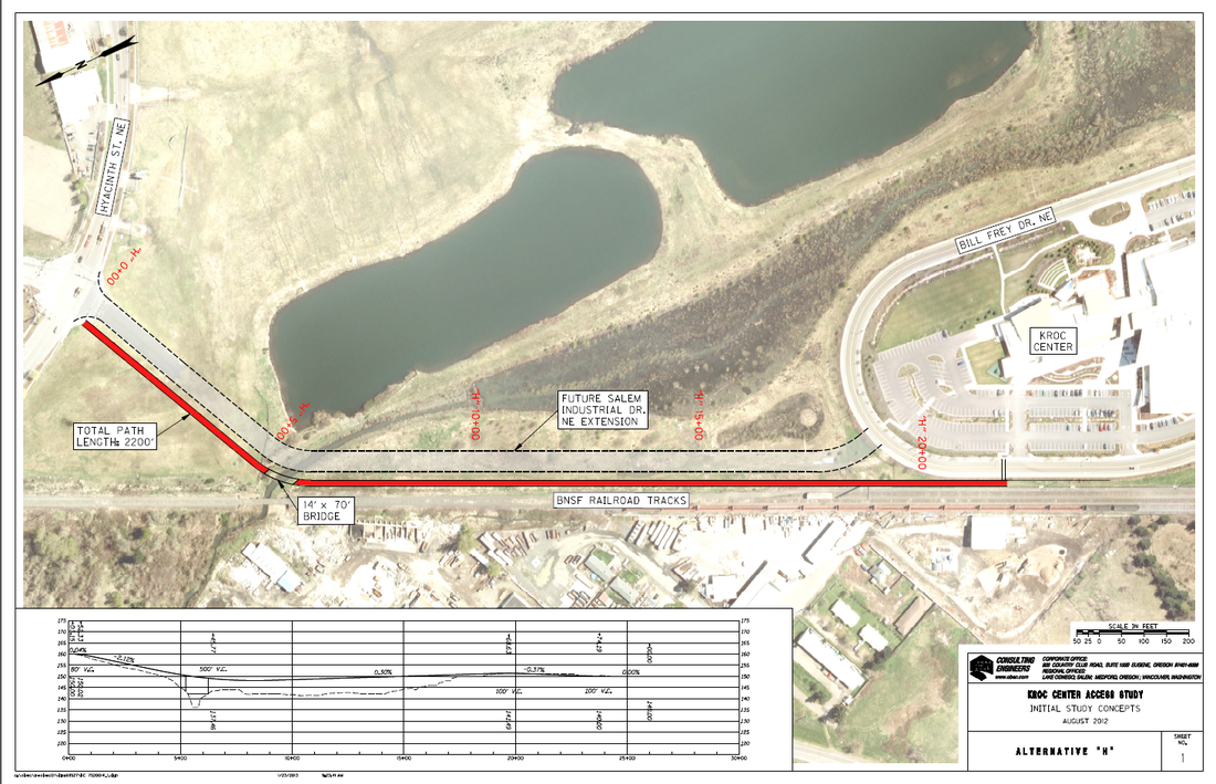
Alternative "H": At-grade path from Kroc Center to Hyacinth St.
The red line on the map below shows the bicycle and pedestrian path from the Bill Frey Drive "loop" to Hyacinth Street. It includes a bridge over Claggett Creek. Note: next to the path is shown the alignment for a future road extension (shown with dashed lines), but this is only included for reference and is not part of the alternative.
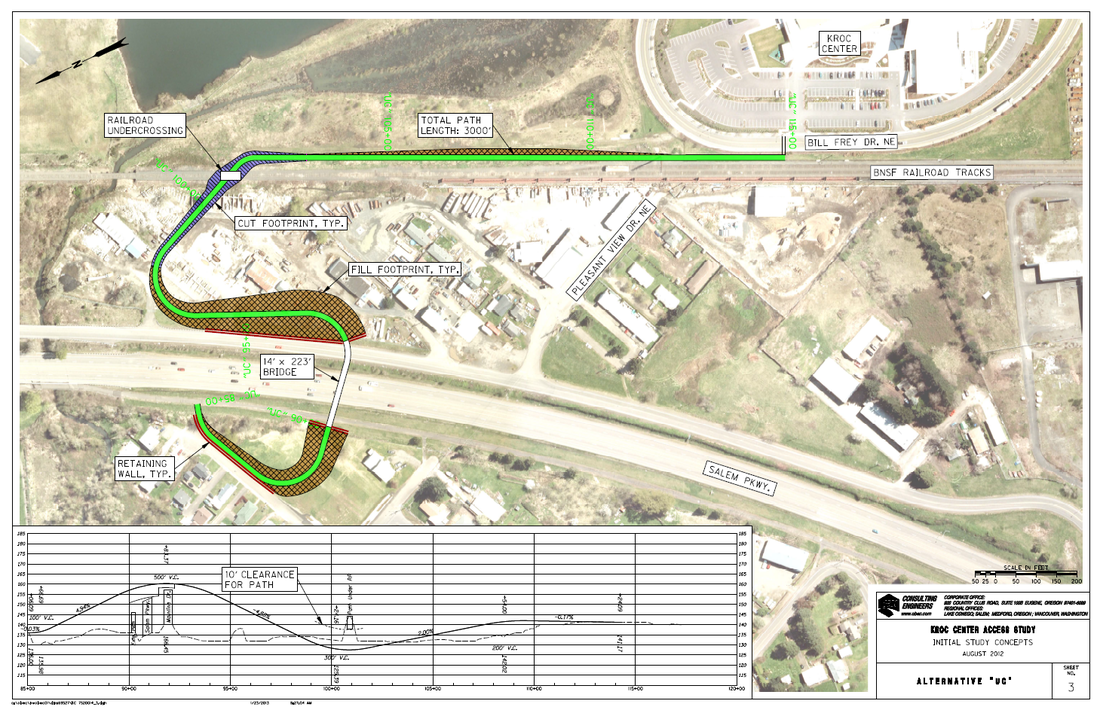
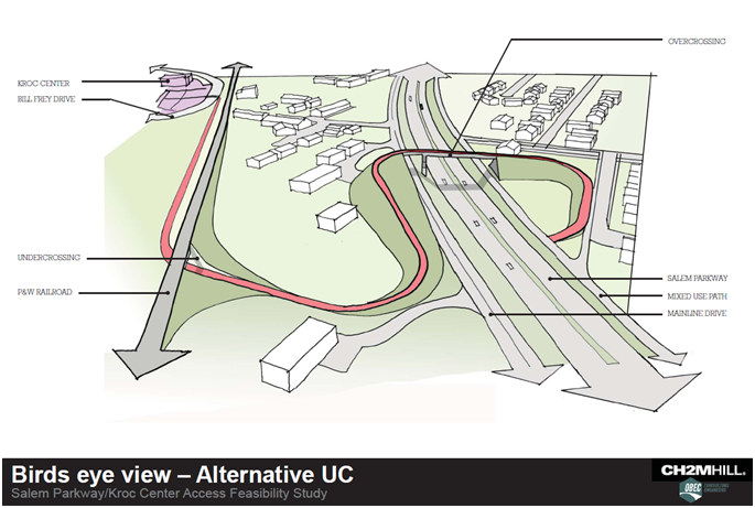
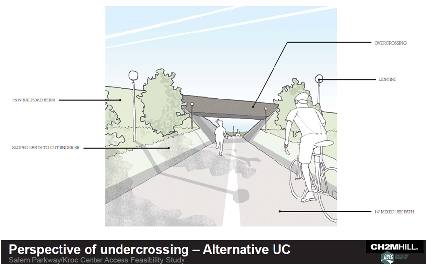
Alternative "UC" - Bridge over Salem Parkway, with undercrossing of railroad tracks
This alignment (colored green) connects to the bike and pedestrian path parallel to Salem Parkway, goes over Salem Parkway, drops back to grade east of Mainline Drive, goes under the railroad tracks, and connects to Bill Frey Drive along the same alignment as Alternative "H"
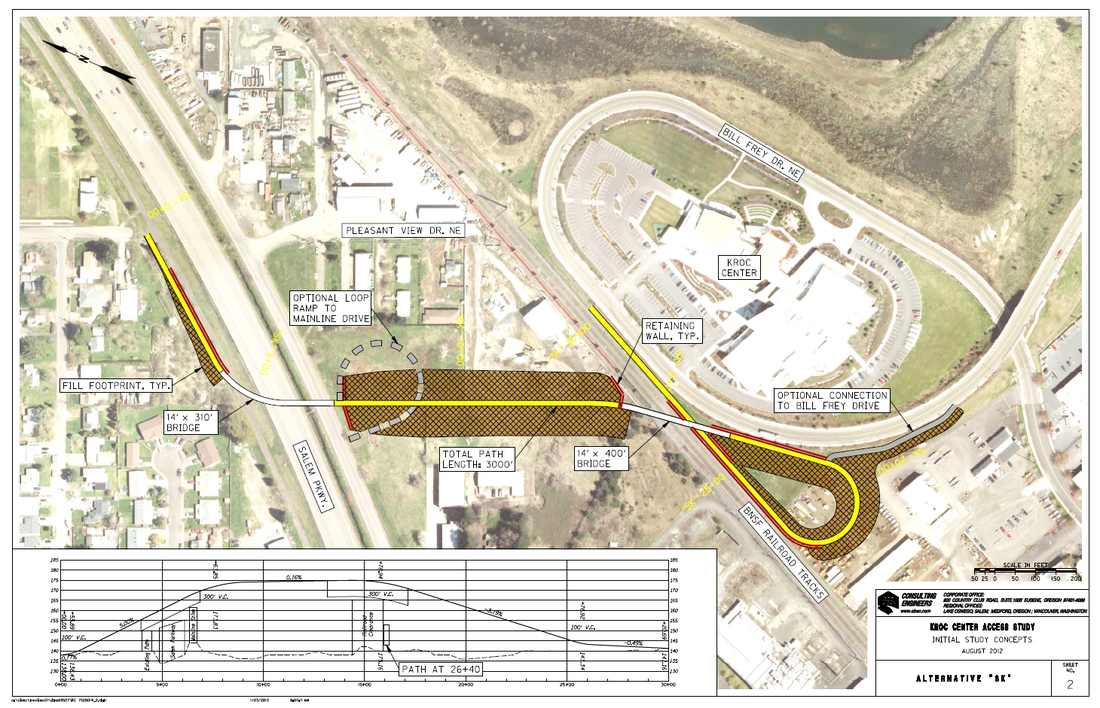
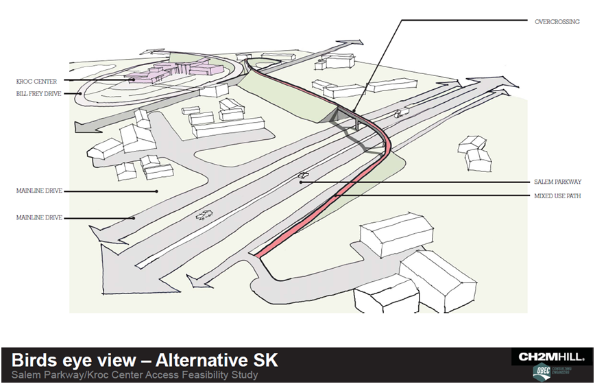
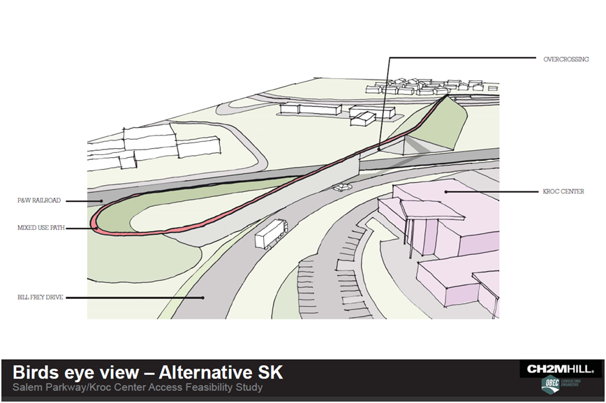
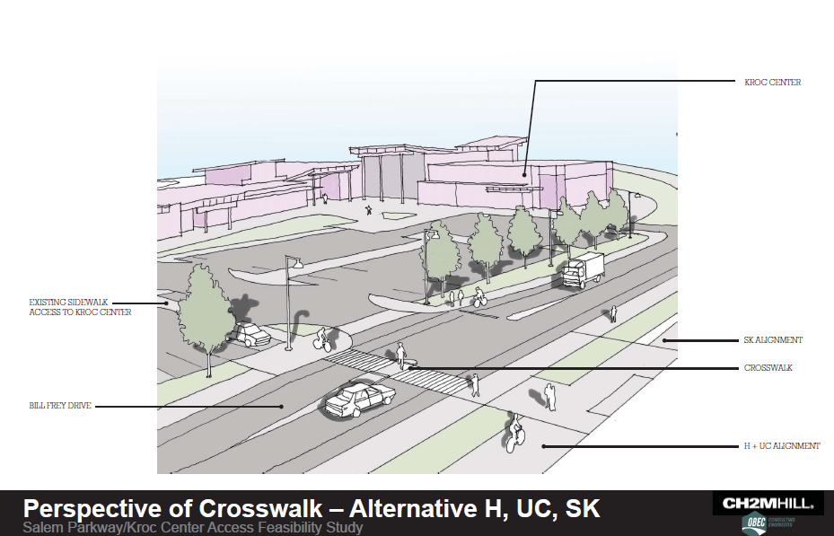
Alternative "SK" - Bridge over Salem Parkway + bridge over railroad tracks
This alignment (colored yellow) connects to the bike and pedestrian path parallel to Salem Parkway, goes over Salem Parkway, continues on a elevated berm and bridge over the railroad tracks, then has a loop east of the rail tracks as it comes back down to grade, ending across from the Kroc Center main driveway. The small loop ramp (colored grey) is an optional connection to Mainline Drive.